
National Land Commission

Vacancy Announcement – Assistant Planning Officer

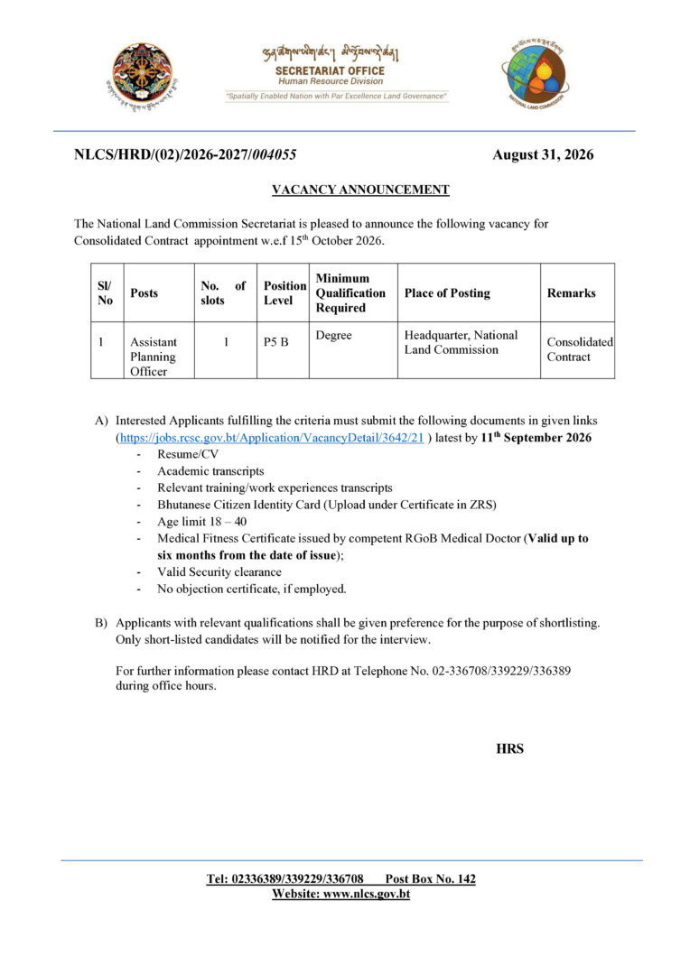
The National Land Commission Secretariat is pleased to announce one vacancy for the post of Assistant Planning Officer (P5 B) on a Consolidated Contract basis, with effect from 15th October 2026.

Position Details:

  • Position: Assistant Planning Officer
  • No. of Slots: 1
  • Position Level: P5 B
  • Minimum Qualification: Degree
  • Place of Posting: Headquarters, National Land Commission
  • Application Deadline: 11th September 2026

Interested and eligible applicants are requested to submit their applications and required documents through the designated online application link.

Apply online: https://jobs.rsc.gov.bt/Application/VacancyDetail/3642/21

For further information, contact HRD at 02-336708 / 339229 / 336389 during office hours.
Announcement

Relaxation of Attestation Requirement for Documents Relating to Land Transactions Executed Overseas

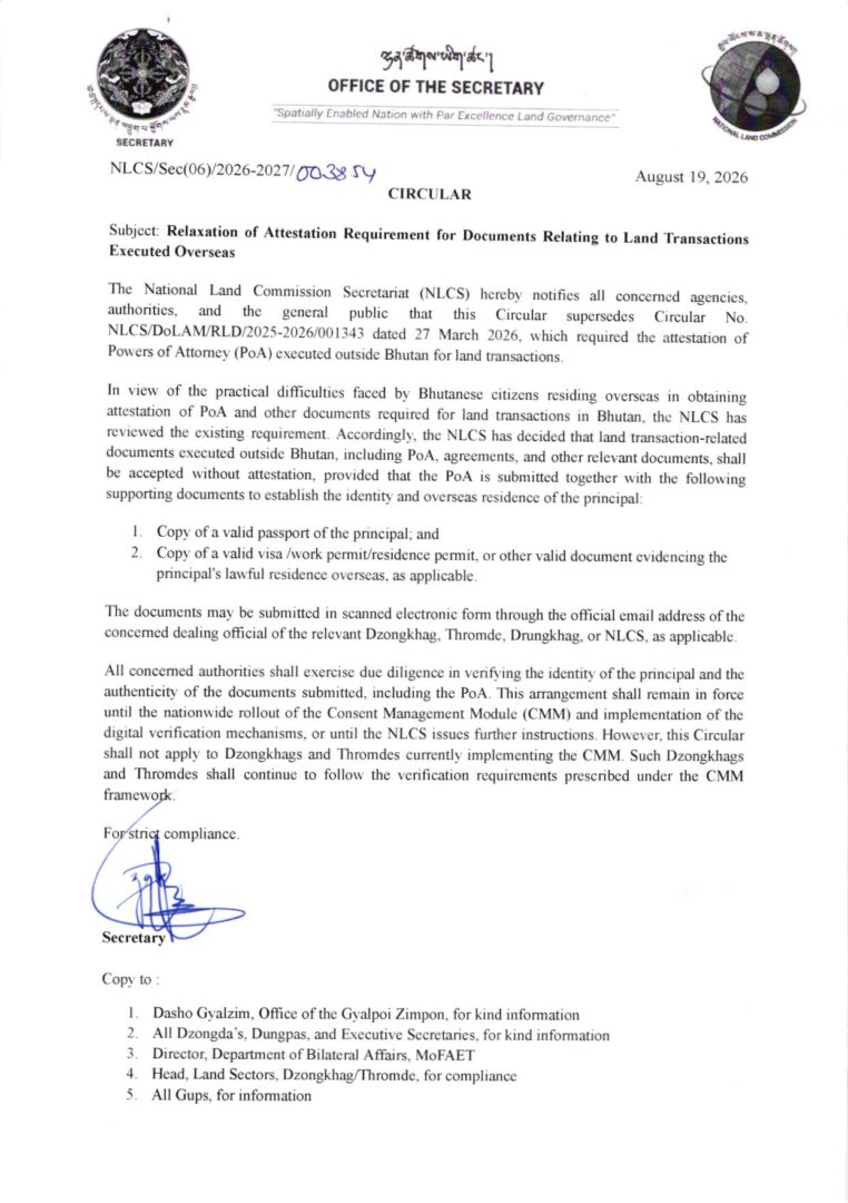
The National Land Commission Secretariat (NLCS) has issued a Circular dated 19 August 2026 regarding the relaxation of attestation requirements for documents related to land transactions executed outside Bhutan.

Under the new arrangement, Power of Attorney (PoA), agreements, and other relevant land transaction documents executed overseas may be accepted without attestation, provided that the PoA is submitted along with a valid passport and a valid visa, work permit, residence permit, or other valid document confirming the principal’s lawful overseas residence.

The supporting documents may be submitted in scanned electronic form through the official email address of the concerned Dzongkhag, Thromde, Drungkhag, or NLCS. The concerned authorities will conduct due diligence to verify the identity of the principal and authenticity of the submitted documents.

Public Announcement

Introducing Bhutan’s National Spatial Data Infrastructure (NSDI)

The National Spatial Data Infrastructure (NSDI) is a national platform that brings together location-based information from different government agencies, making it easier to discover, access, share and use geospatial data.

NSDI is established through the collaboration between the National Land Commission Secretariat (NLCS) and JICA, it was developed to strengthen the way spatial information is managed and shared in Bhutan.

The platform brings together CGI members and data-contributing agencies which creates a collaborative network for sharing and managing geospatial information across the country. It also supports the concept of a Single Source of Truth (SSOT) which help agencies work with authoritative and reliable spatial information and reducing duplication of data.

This short video provides a simple introduction to NSDI, its history, purpose, members and data contributors, as well as how the platform can be used to explore Bhutan’s geospatial information.

Watch the video to learn how shared maps and data can support better planning, informed decisions and improved public services.

https://www.facebook.com/share/v/1DP5uDZw3R/

Scroll to Top