National Land Commission

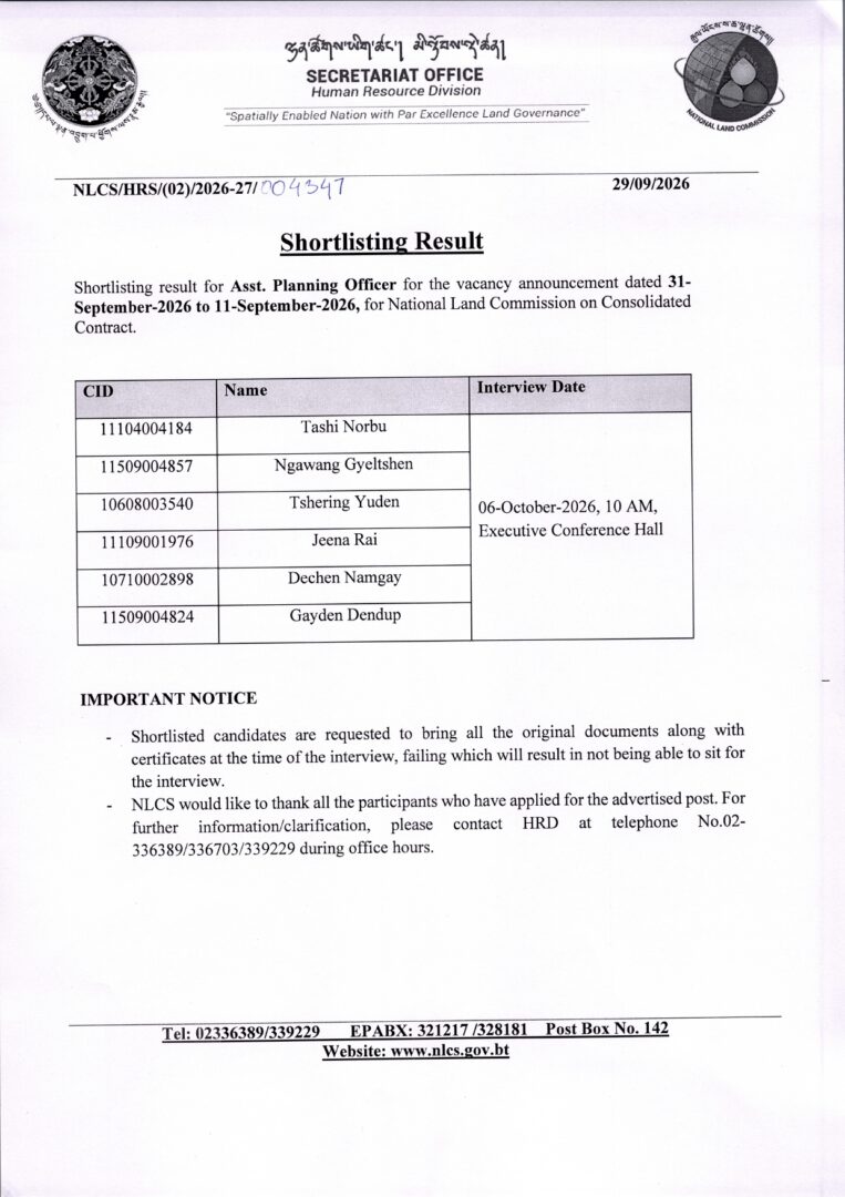
Shortlisting Result

Shortlisting result forAsst. Planning Officerfor the vacancy announcement dated 31-September-2026 to 11-September-2026,for National Land Commission on Consolidated Contract.

Public Announcement

Introducing Bhutan’s National Spatial Data Infrastructure (NSDI)

The National Spatial Data Infrastructure (NSDI) is a national platform that brings together location-based information from different government agencies, making it easier to discover, access, share and use geospatial data.

NSDI is established through the collaboration between the National Land Commission Secretariat (NLCS) and JICA, it was developed to strengthen the way spatial information is managed and shared in Bhutan.

The platform brings together CGI members and data-contributing agencies which creates a collaborative network for sharing and managing geospatial information across the country. It also supports the concept of a Single Source of Truth (SSOT) which help agencies work with authoritative and reliable spatial information and reducing duplication of data.

This short video provides a simple introduction to NSDI, its history, purpose, members and data contributors, as well as how the platform can be used to explore Bhutan’s geospatial information.

Watch the video to learn how shared maps and data can support better planning, informed decisions and improved public services.

https://www.facebook.com/share/v/1DP5uDZw3R/

📢 Public Announcement

📢 Public Announcement

The National Land Commission Secretariat (NLCS) is pleased to announce the pilot rollout of the Consent Management Module (CMM) under the eSakor system in Thimphu, Phuentsholing, and Paro starting from 2nd June 2026. Accordingly, all land transactions in these three Dzongkhags will be required to obtain consent before processing, with effect from 2nd June 2026.

The Consent Management Module (CMM) is a new feature that enables landowners, family members, and witnesses to provide their consent digitally during land transactions. This ensures that all parties involved are informed and have formally agreed before any transaction is processed.

🎯 Why it matters
✔️Prevents fraudulent land transactions
✔️Protects landowners’ rights
I✔️mproves transparency & accountability
✔️Ensures no stakeholder is left uninformed

⚙️ Key Features
✔️ Mandatory consent from all parties
✔️ Additional verification before transactions
✔️ Secure access via National Digital Identity (NDI)
✔️ Inclusive system for those without digital access

📢 Further information and guidance materials will be made available on our official platforms, including our website and Instagram, to guide citizens on how to use the system.

https://www.facebook.com/reel/2194826044603168

Registration for CLC Training

Registration for CLC Training

The National Land Commission is pleased to announce open registration for the upcoming Certified Land Conveyancer (CLC) Training, which will be conducted from 16th March to 20th March 2026.
Interested individuals with at least a Diploma in Surveying are invited to register for the training, as seats are limited. The training aims to enhance participants’ knowledge and skills in land conveyancing procedures and the use of esakor systems.

Training Details
Program: Certified Land Conveyancer (CLC) Training
Organizer: National Land Commission
Dates: 16th – 20th March, 2026
Registration: Open on a first-come, first-served basis
Eligibility: Minimum qualification of a Diploma in Surveying
Eligible and interested participants may register using the following link: https://forms.gle/QtnEVgcrw9zEB6Ur8

For further information, please contact Pema Lhadon at 77747353/plhadon@nlcs.gov.bt or Kinzang Lhamo at 17555190/kinzanglhamo95@gmail.com

Notification

Cadastral licensing exam 2026

The Cadastral Information Division, Department of Survey & Mapping (NLCS) would like to inform all eligible cadastral surveyors that the Cadastral Licensing Examination will be conducted from 9–12 February 2026.

All eligible surveyors are requested to contact the point person regarding their cadastral licensing applications at the earliest. Please note that the examination application will close on Friday, 23 January 2026.

Point Person:
Phuntsho Tashi
WhatsApp: 17447581

Candidates are also requested to make themselves available as per the examination schedule and refer to the official notification/email for details on venue and further instructions. Any updates will be communicated accordingly.

— Cadastral Information Division, DoSAM, NLCS

Click here


Shortlisting Result

Shortlisting result for Surveyor I for the vacancy announcement dated 30-June-2025 to 12-Nov-2023, For Haa Dzongkhag on Regular Appointment
CID Name
10308002691
Krishna Maya Rai
10312000704
Amith Majhi
10716002390
Tandin Dorji
11102002741
Samten Norbu
11107007928
Chimi Delkar
11107008000
Sonam Drukpa
11203002965
Sonam Choki Ghalley
11213003872
Sonam Lhamo
11303000310
Sonam Wangchuk Gurung
11308001870
Silash Gurung
11308006134
Lali Maya Gurung
11606000718
Thinley Choden

Interview Date : 21 August 2025, 9:30 AM, Executive Conference Hall

Important Notice : Shortlisted candidates are requested to bring all original documents along with certificates at the time of the interview. Failure to do so will result in ineligibility to sit for the interview.

Download the Announcement


Vacancy for the Post of Surveyor I (Haa Dzongkhag, Land & Survey Sector)

The National Land Commission Secretariat is pleased to announce the following vacancy for Regular appointment w.e.f 1st September 2025. 

Sl no Post No. of Slots Position Level Minimum Qualification Required Place of Posting Remarks
1
Surveyor I
1
S2 A
Diploma in Surveying
Haa Dzongkhag, Land & Survey Sector
Regular

A) Interested Applicants fulfilling the criteria must submit the following documents in given links (https://jobs.rcsc.gov.bt/Application/VacancyDetail/3642/18) latest by 12th August 2025

– Resume/CV
– Academic transcripts
– Relevant training/work experiences transcripts
– Bhutanese Citizen Identity Card (Upload under Certificate in ZRS)
– Age limit 18 – 40
– Medical Fitness Certificate issued by competent RGoB Medical Doctor (Valid up to six months from the date of issue);
– Valid Security clearance
– No objection certificate, if employed.

B) Applicants with relevant qualifications shall be given preference for the purpose of shortlisting. Only short-listed candidates will be notified for the interview.

For further information please contact HRD at Telephone No. 02-336708/339229/336389 during office hours.

Download Here

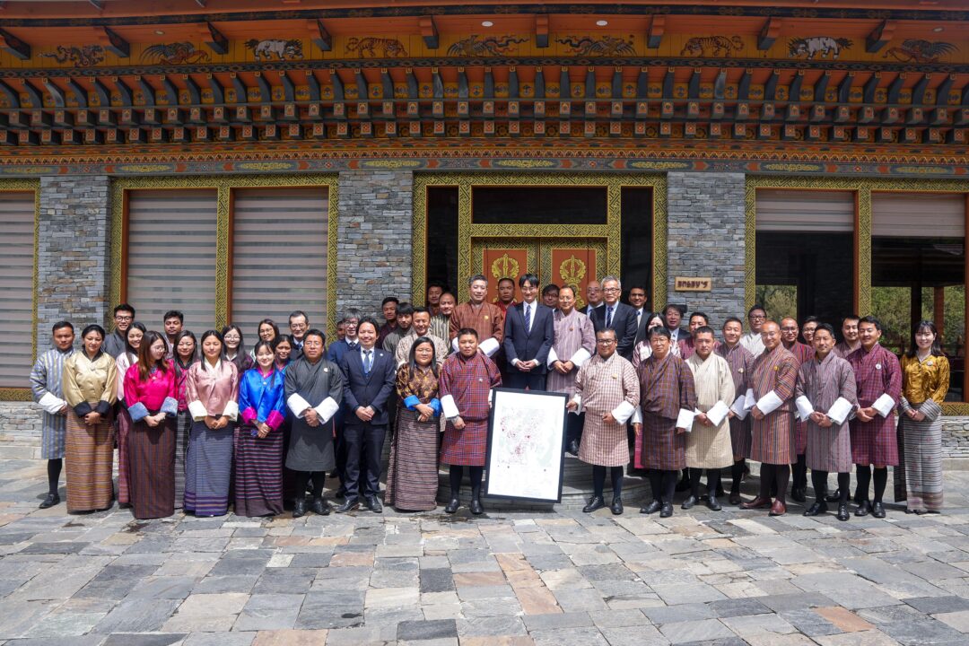
Handover Ceremony for the “Project for the Development of the Digital Topographic Map in Bhutan”

On 18th April, 2025, JICA Bhutan handed over the Topographic Maps of 1:25,000 and 1:5000 scale to the National Land Commission Secretariat (NLCS) at the Terma Linca Resort and Spa. The 1:25,000 scale map covers the North-Central region of the country of about 17,294 km² while the 1:5,000 scale map covers nine major urban areas of the country of about 500 km². With this, the 1:25,000 scale map now covers approximately 75% of the country’s total area.

Considering the critical need of the topographic maps in the decision-making for development plans in numerous fields such as infrastructure planning, urban development, disaster risk management, environmental conservation, land management and rationalization of NSDI among others, JICA supported this project through the Grant Aid for NLCS.

The project was executed by PASCO Corporation and Air Asia Survey as a Joint Venture (JV) from December 2022 to April 2025 (two years and five months). Aero Asahi Corporation and Yachiyo Engineering Co., Ltd. served as the consultants on behalf of the NLCS.

Under this project, three major deliverables are included:

  1. Digital Topographic Maps
  2. Digital Elevation Model (DEM)
  3. High-resolution satellite images.

The satellite images were already handed over to the NLCS on 17th April 2024.

The NLCS on behalf of the Royal Government of Bhutan shall remain indebted to JICA and Government of Japan for their assistance.

The handover ceremony was attended by Chief Representative of JICA Bhutan, Hon’ble Secretary of GovTech Agency, Hon’ble Secretary of International Boundary, Directors, Chiefs and representatives from various agencies including the private geospatial firm involved in the project.

Scroll to Top