National Land Commission

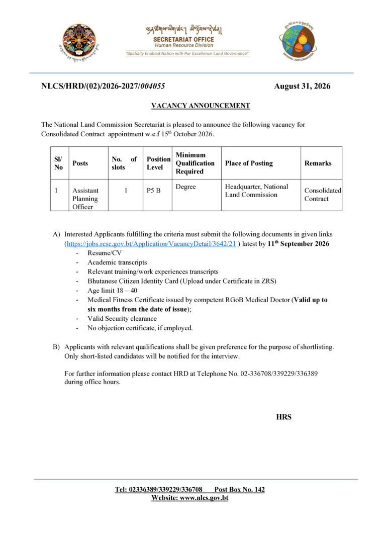
Vacancy Announcement – Assistant Planning Officer

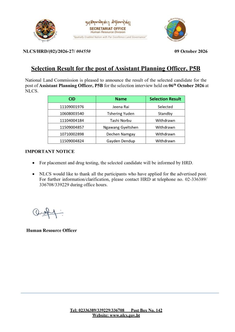
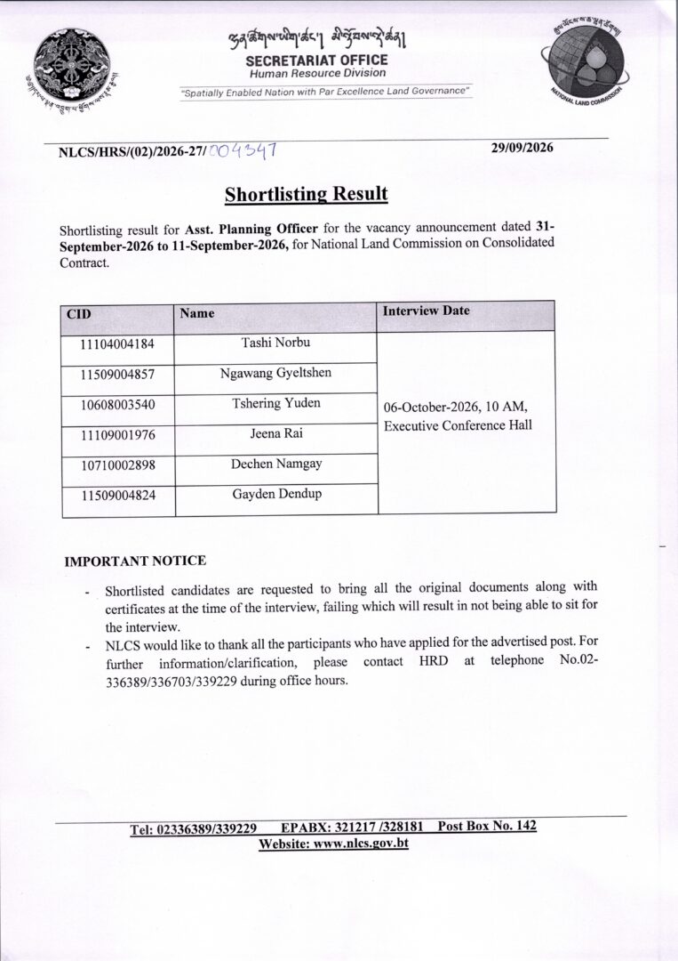
The National Land Commission Secretariat is pleased to announce one vacancy for the post of Assistant Planning Officer (P5 B) on a Consolidated Contract basis, with effect from 15th October 2026.

Position Details:

  • Position: Assistant Planning Officer
  • No. of Slots: 1
  • Position Level: P5 B
  • Minimum Qualification: Degree
  • Place of Posting: Headquarters, National Land Commission
  • Application Deadline: 11th September 2026

Interested and eligible applicants are requested to submit their applications and required documents through the designated online application link.

Apply online: https://jobs.rsc.gov.bt/Application/VacancyDetail/3642/21

For further information, contact HRD at 02-336708 / 339229 / 336389 during office hours.

Announcement

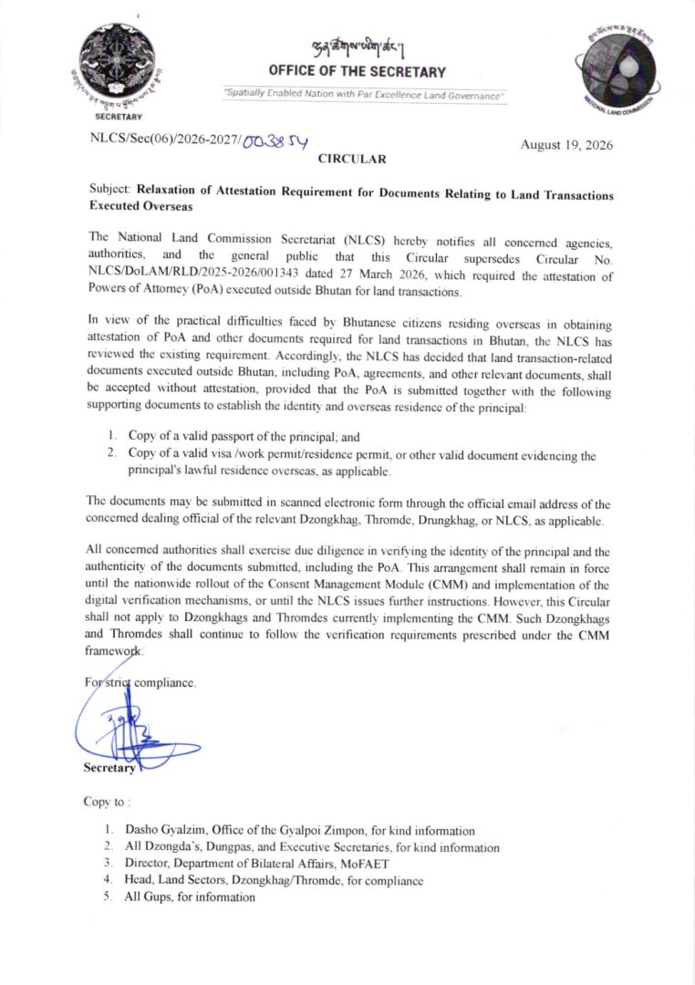
Relaxation of Attestation Requirement for Documents Relating to Land Transactions Executed Overseas

The National Land Commission Secretariat (NLCS) has issued a Circular dated 19 August 2026 regarding the relaxation of attestation requirements for documents related to land transactions executed outside Bhutan.

Under the new arrangement, Power of Attorney (PoA), agreements, and other relevant land transaction documents executed overseas may be accepted without attestation, provided that the PoA is submitted along with a valid passport and a valid visa, work permit, residence permit, or other valid document confirming the principal’s lawful overseas residence.

The supporting documents may be submitted in scanned electronic form through the official email address of the concerned Dzongkhag, Thromde, Drungkhag, or NLCS. The concerned authorities will conduct due diligence to verify the identity of the principal and authenticity of the submitted documents.

Public Announcement

Introducing Bhutan’s National Spatial Data Infrastructure (NSDI)

The National Spatial Data Infrastructure (NSDI) is a national platform that brings together location-based information from different government agencies, making it easier to discover, access, share and use geospatial data.

NSDI is established through the collaboration between the National Land Commission Secretariat (NLCS) and JICA, it was developed to strengthen the way spatial information is managed and shared in Bhutan.

The platform brings together CGI members and data-contributing agencies which creates a collaborative network for sharing and managing geospatial information across the country. It also supports the concept of a Single Source of Truth (SSOT) which help agencies work with authoritative and reliable spatial information and reducing duplication of data.

This short video provides a simple introduction to NSDI, its history, purpose, members and data contributors, as well as how the platform can be used to explore Bhutan’s geospatial information.

Watch the video to learn how shared maps and data can support better planning, informed decisions and improved public services.

https://www.facebook.com/share/v/1DP5uDZw3R/

📢 Public Announcement

📢 Public Announcement

The National Land Commission Secretariat (NLCS) is pleased to announce the pilot rollout of the Consent Management Module (CMM) under the eSakor system in Thimphu, Phuentsholing, and Paro starting from 2nd June 2026. Accordingly, all land transactions in these three Dzongkhags will be required to obtain consent before processing, with effect from 2nd June 2026.

The Consent Management Module (CMM) is a new feature that enables landowners, family members, and witnesses to provide their consent digitally during land transactions. This ensures that all parties involved are informed and have formally agreed before any transaction is processed.

🎯 Why it matters
✔️Prevents fraudulent land transactions
✔️Protects landowners’ rights
I✔️mproves transparency & accountability
✔️Ensures no stakeholder is left uninformed

⚙️ Key Features
✔️ Mandatory consent from all parties
✔️ Additional verification before transactions
✔️ Secure access via National Digital Identity (NDI)
✔️ Inclusive system for those without digital access

📢 Further information and guidance materials will be made available on our official platforms, including our website and Instagram, to guide citizens on how to use the system.

https://www.facebook.com/reel/2194826044603168

Notification

Cadastral licensing exam 2026

The Cadastral Information Division, Department of Survey & Mapping (NLCS) would like to inform all eligible cadastral surveyors that the Cadastral Licensing Examination will be conducted from 9–12 February 2026.

All eligible surveyors are requested to contact the point person regarding their cadastral licensing applications at the earliest. Please note that the examination application will close on Friday, 23 January 2026.

Point Person:
Phuntsho Tashi
WhatsApp: 17447581

Candidates are also requested to make themselves available as per the examination schedule and refer to the official notification/email for details on venue and further instructions. Any updates will be communicated accordingly.

— Cadastral Information Division, DoSAM, NLCS

Click here


Notification: Registration and Certification of Cadastral Surveyors

Please be informed that the National Land Commission will be facilitating the registration and certification of cadastral surveyors from Nov 4 to Nov 7, 2024.
All eligible candidates are requested to ensure their availability as per the details provided in the attachments.
The registration application is available here. Interested candidates should fill in the form and send it to the personnel reflected on the application. The deadline for applications is set for 25/10/2024.

Notification on Property Tax

Notification on Property Tax

The Department of Revenue and Custom (DRC) would like to notify the property owners on the following:
1. Joint Ownership
2. Pending Thrams
3. Tax payment for properties in the name of deceased.
4. Vacant Land Tax

Click Here for more details.

Promotion of Utilization of Geospatial Information

Promotion of Utilization of Geospatial Information

The 2nd seminar for the technical cooperation project with JICA on ” The project for the Promotion of Utilization of Geospatial Information through the Development of National Spatial Data Infrastructure (NSDI) for Bhutan” was held on 11th October 2023 at the National Land Commission.

During the seminar, the project management team provided an overview and progress of all the activities associated with the project’s two main outputs which are;
1. Capacity development for the operation planning and implementation for the strategic utilization and promotion of NSDI.
2. Capacity development for making, updating, management, and utilization of digital topographic map.
Additionally, external stakeholders, including Thimphu Thromde and the Department of Local Governance and Disaster Management, made presentations on ”Building mobility data of city buses with General Transit Feeds Specification ” and ”Disaster Risk Management Portal” respectively.
The primary objective of this seminar was to raise awareness, foster closer collaboration, and keep member agencies of the Centre for Geo-Information and other key stakeholders, informed about the project’s progress.

Scroll to Top