National Land Commission

Successful Conclusion of Executive-Level Meeting on NSDI

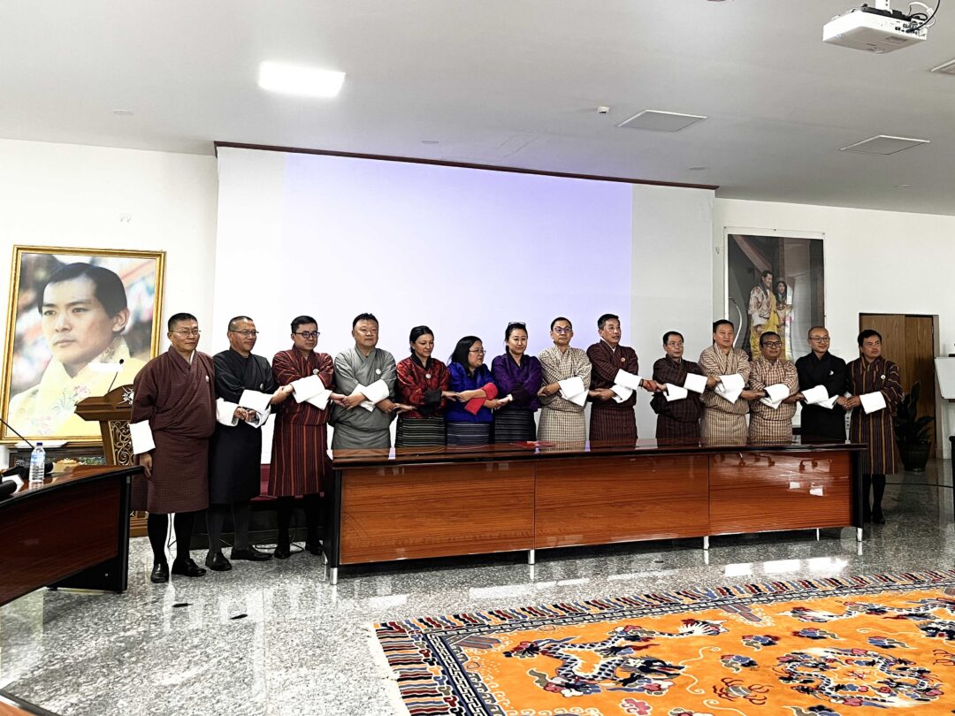
The executive-level meeting on the National Spatial Data Infrastructure (NSDI) has concluded successfully, marked by the signing of a Memorandum of Understanding (MoU) between the Centre for Geo-Information (NLCS) and various member agencies. This pivotal agreement, titled “MoU between the Centre for Geo-Information (NLCS) and Member Agencies for Geospatial Data Management and Sharing through the Bhutan National Spatial Data Infrastructure,” establishes a formal collaboration for the integration, management, and sharing of spatial data through the NSDI system.

Upcoming Workshop on Spatial Data Integration

In alignment with the consensus reached during the executive meeting, we are pleased to announce an upcoming workshop scheduled for the first week of November. This workshop will engage working-level groups to focus on integrating spatial data from each agency into the NSDI system, ensuring that it is prepared for public accessibility.

Acknowledgements

We extend our sincere gratitude to all participants for their contributions, which facilitated productive discussions and the successful outcomes of the executive-level meeting. This MoU marks a significant advancement in our collaborative efforts and the ongoing development of NSDI initiatives in Bhutan.

Stay tuned for further updates!

Vacancy Announcement: Surveyor I

The National Land Commission Secretariat is pleased to announce a vacancy for the position of Surveyor I. We are looking for dedicated individuals to join our team for a Regular Appointment starting from January 1, 2025.

Position Details:

  • Number of Slots: 3
  • Position Level: S2A
  • Minimum Qualification Required: Diploma in Surveying
  • Place of Posting: Land and Survey Sector, Mongar, Dagana, and Zhemgang

Application Process: Interested applicants who meet the criteria must submit the following documents through the provided link: Application Link

Application Period:

  • Start Date: October 26, 2024
  • Deadline: November 5, 2024

Required Documents:

  • Resume/CV
  • Academic transcripts
  • Relevant training/work experience transcripts
  • Bhutanese Citizen Identity Card
  • Medical Fitness Certificate (issued by a competent RGoB Medical Doctor, valid up to six months from the date of issue)
  • Security clearance
  • No objection certificate (if currently employed)

Important Notes:

  • Applicants with relevant qualifications, training, and work experience will be given preference for shortlisting.
  • Only shortlisted candidates will be notified for the interview.

For further information, please contact the HRD at:

  • Telephone: 02-336708 / 339229 / 336389 (during office hours)

Notification: Registration and Certification of Cadastral Surveyors

Please be informed that the National Land Commission will be facilitating the registration and certification of cadastral surveyors from Nov 4 to Nov 7, 2024.
All eligible candidates are requested to ensure their availability as per the details provided in the attachments.
The registration application is available here. Interested candidates should fill in the form and send it to the personnel reflected on the application. The deadline for applications is set for 25/10/2024.

Enhancing Land Security: Upgrading eSakor with National Digital Identity

Enhancing Land Security: Upgrading eSakor with National Digital Identity

The National Land Commission Secretariat (NLCS) is upgrading eSakor with the National Digital Identity (NDI) system to enhance security. This upgrade will protect against unauthorized access, reducing risks like online impersonation and fraudulent land transactions.

We are working closely with GovTech to implement this feature quickly, ensuring minimal disruption. To learn more about the benefits of the NDI platform, please watch our promotional video. 

Click to watch


Re-Vacancy Announcement

The National Land Commission Secretariat is pleased to announce the following vacancy:

Position: Chief Land Registrar
No. of Slots: 2
Position Level: P1 A
Minimum Qualification Required: Bachelor’s degree (General) / Bachelors with 500 Survey Engineering Course
Place of Posting: Land Management Division & Rural Land Division, NLCS, Thimphu
Remarks: In-Service

Application Period:

  • Start Date: 28th August 2024
  • Deadline: 20th September 2024

Eligibility Criteria:
Interested in-service civil servants may apply. For detailed eligibility criteria and required documents, please refer to the following links:

We encourage all eligible candidates to apply and wish you the best of luck!

Vacancy Announcement for chief Land Registrar

Interested in-service civil servants who meet the eligibility criteria for Chief Land Registrar as per Section 11.7.3 of the Chapter 11: Senior civil service of the BCSR 2023 may apply w.e.f. 28/08/24 with the following documents to HRD latest by 10th September 2024.

  • Application
  • Curriculum Vitae as per the format approved by RCSC (ZEST)
  • Attested copy of Academic transcripts
  • Attested copy of relevant training/work experience transcripts
  • Audit and security clearance
  • Copy of Moderation result (MAX) – (2022-2023 and 2023-2024)
  • No Objection Certificate from working and parent agency
  • Certificate of Mandatory Integrity test (Level 1&2)

For further information please contact HRD at Telephone No. 02-336389/dtshomo@nlcs.gov.bt during office hours.

Download the full announcement PDF here

LAND TRANSACTION STATISTICAL REPORT 2023-2024

Land Transaction Statistical Report 2023-2024​

This consolidated statistical report provides a comprehensive analysis of rural and urban land transactions across Dzongkhags and Thromdes, with the aim of understanding land dynamics.
The quantitative analysis of land transaction approved by the three division, the Rural Land Division, Urban Land Division, and Land Management Division thereby promotes transparency and accountability, and enhances public service delivery for sustainable land management.

Full Report Click Here 

Advancing Geospatial Infrastructure: Highlights from the 4th JCC Meeting

Advancing Geospatial Infrastructure: Highlights from the 4th JCC Meeting

On May 21, 2024, the National Land Commission and the JICA counterpart of the project organized the 4th Joint Coordination Committee (JCC) meeting for the project on “Promotion of Utilization of Geospatial Information through Development of National Spatial Data Infrastructure.” During the meeting, project team members provided updates on the overall progress and achievements of the project’s two outputs.
Output 1: Capacity development for operational planning and implementation for the strategic utilization and promotion of NSDI.
Output 2: Capacity development for creating, updating, managing, and utilizing digital topographic maps.
The project’s activities focus on developing a common geospatial data-sharing platform, establishing geographic information standards, and creating one of the fundamental geospatial datasets: the digital topographic map with resolutions of 1:25,000 and 1:5,000.

Scroll to Top