The National Land Commission Secretariat is pleased to announce the shortlisted candidates for the post of Land Record Assistant and Survey Associate. Please click the following to view the details. Land Record Assistant Survey Associate
Selected Candidates For Land Record Assistant And Survey Associate
The National Land Commission Secretariat is pleased to announce the selection result for the post of Land Record Assistant and Survey Associate. Please click below to view the details. Result for Land Record Assistant Result For Survey Associate
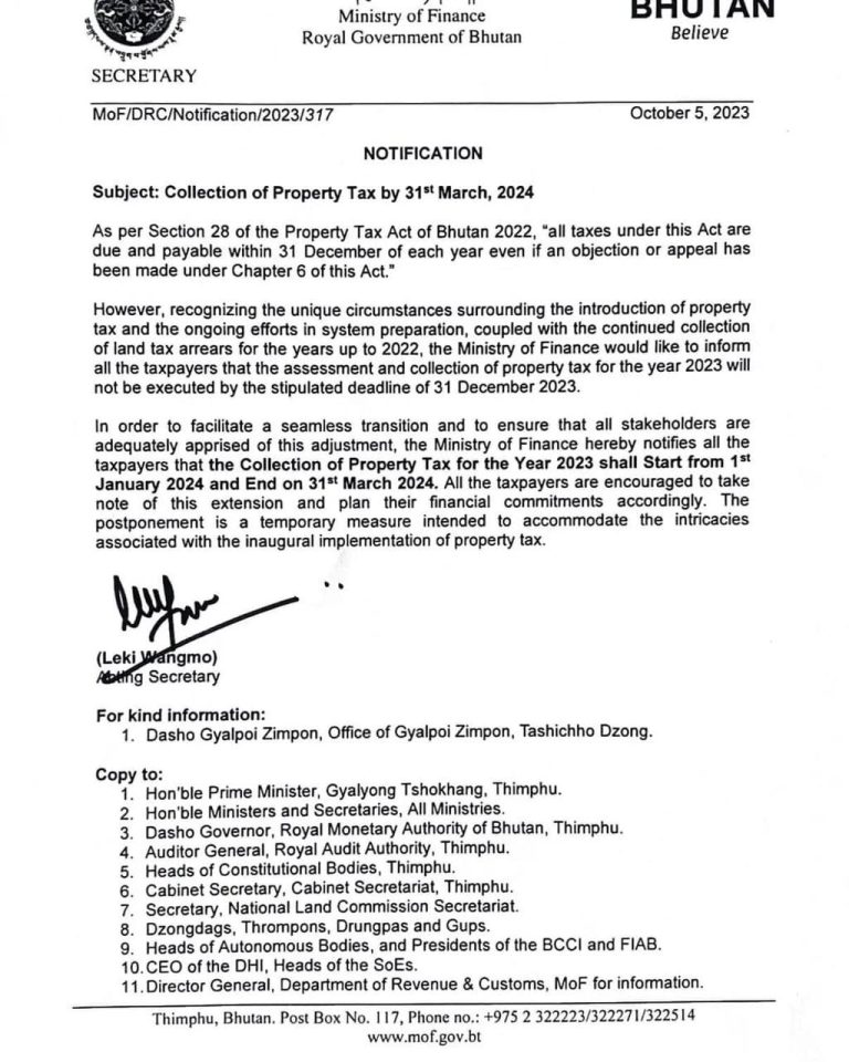
Implementation of revised State Land Lease Rates 2023
State Land (SL) leasing in the country plays crucial role in land management, urban development and economic growth.It provides oppotunities for individuals, public and private entities toutilize land resources for commercial, industrial, agricultural or recreational purpose. The NLCS would like to inform all the relevant stakeholders to implement the revised ” State Land Lease Rates 2023 “ Click Here to Download The State Land Lease Revised Rates 2023
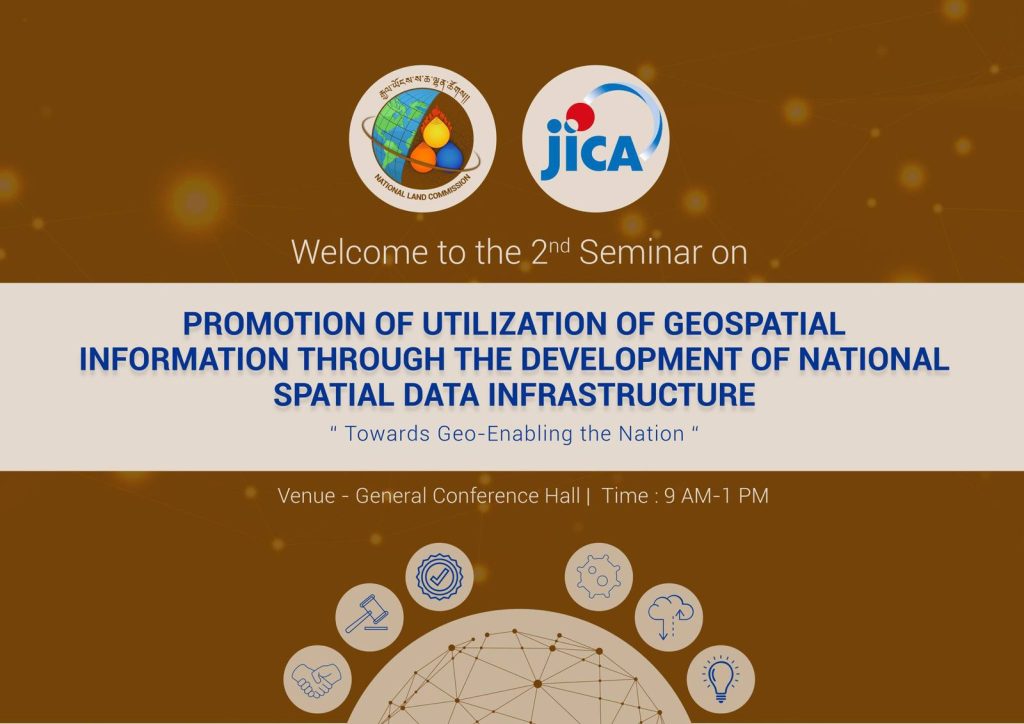
Promotion of Utilization of Geospatial Information
The 2nd seminar for the technical cooperation project with JICA on ” The project for the Promotion of Utilization of Geospatial Information through the Development of National Spatial Data Infrastructure (NSDI) for Bhutan” was held on 11th October 2023 at the National Land Commission.
During the seminar, the project management team provided an overview and progress of all the activities associated with the project’s two main outputs which are; 1. Capacity development for the operation planning and implementation for the strategic utilization and promotion of NSDI. 2. Capacity development for making, updating, management, and utilization of digital topographic map. Additionally, external stakeholders, including Thimphu Thromde and the Department of Local Governance and Disaster Management, made presentations on ”Building mobility data of city buses with General Transit Feeds Specification ” and ”Disaster Risk Management Portal” respectively. The primary objective of this seminar was to raise awareness, foster closer collaboration, and keep member agencies of the Centre for Geo-Information and other key stakeholders, informed about the project’s progress.
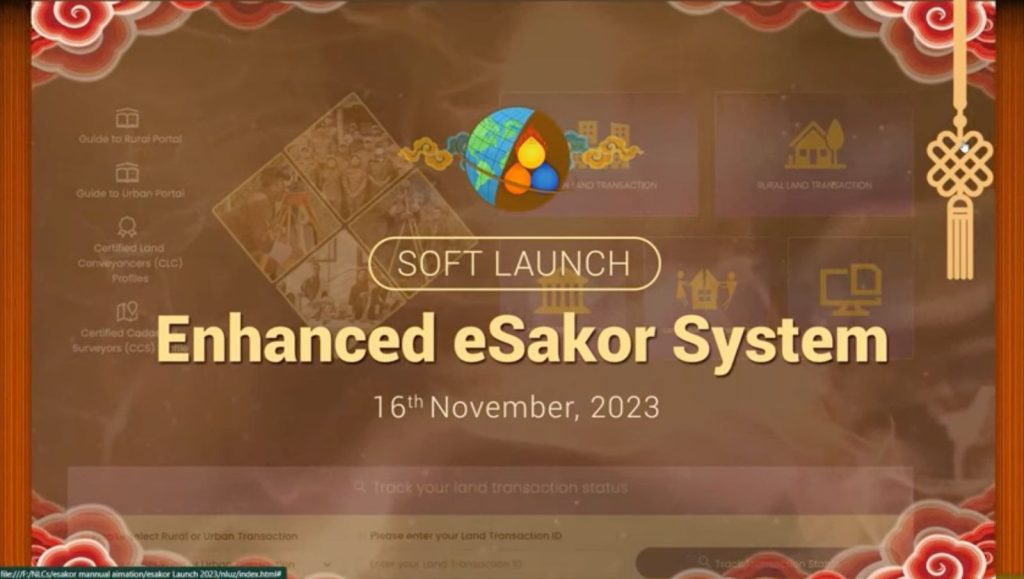
We are thrilled to announce the launch of the upgraded eSakor system. The system is now accessible to all citizens through https://esakor.nlcs.gov.bt and can also be reached via the NLCS website www.nlcs.gov.bt.